 ເທຣດເດີໂທລະທັດ
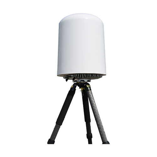
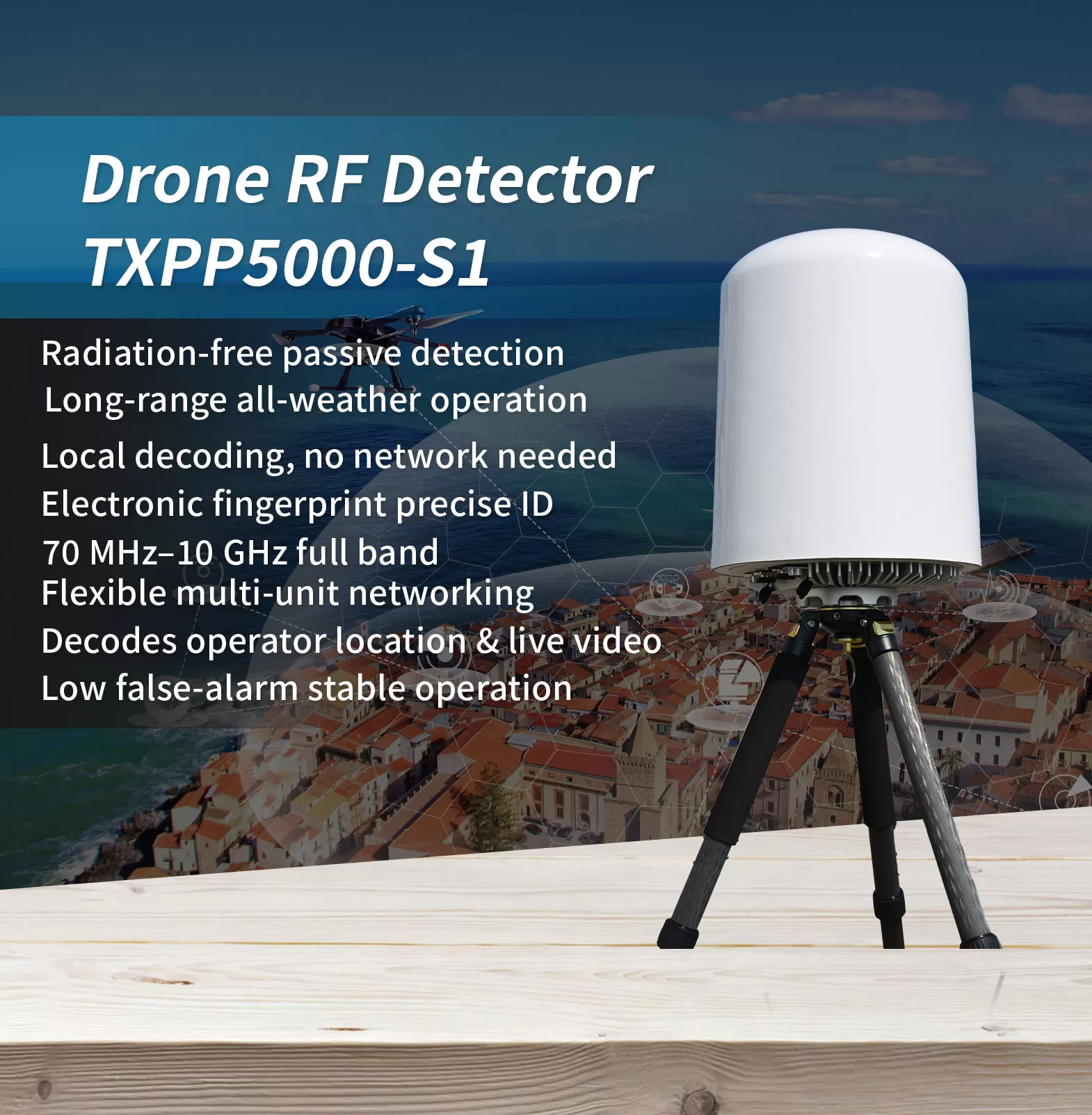
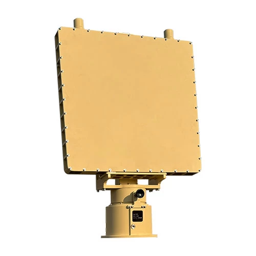
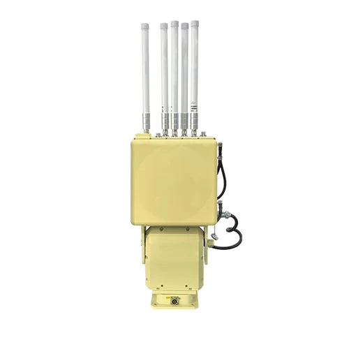
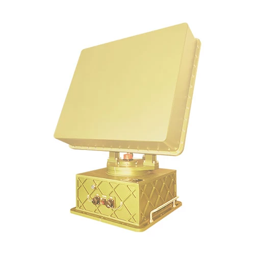
In the landscape of low-altitude threats, the hardest targets to defend against are often the ones you cannot see. FPV drones, modified UAVs, and low-flying “rogue” aircraft frequently evade cameras and radar—yet they cannot hide from radio frequency. This radio detection equipment passively intercepts drone signals without emitting high-power electromagnetic radiation, and keeps working continuously through rain, ໝອກ, ຄວາມມືດ, and building obstructions.
Covering a wide 70 MHz to 10 GHz band (subject to local frequency regulations), it identifies drone video and control links and simultaneously tracks more than 40 ເປົ້າຫມາຍ, with a detection range beyond 5 km that can reach 10 km under favorable conditions, while operating with a low false-alarm rate. It captures the drone’s unique electronic fingerprint (SN), distinguishing individual airframes of the same model and resolving the operator’s location; it decodes domestic and international Remote ID standards such as GB42590-2023, ASTM F3411-22a, and ASD-STAN PrEN4709-002, as well as DJI Drone-ID; it also decodes civil aviation ADS-B broadcasts to provide real-time position information.
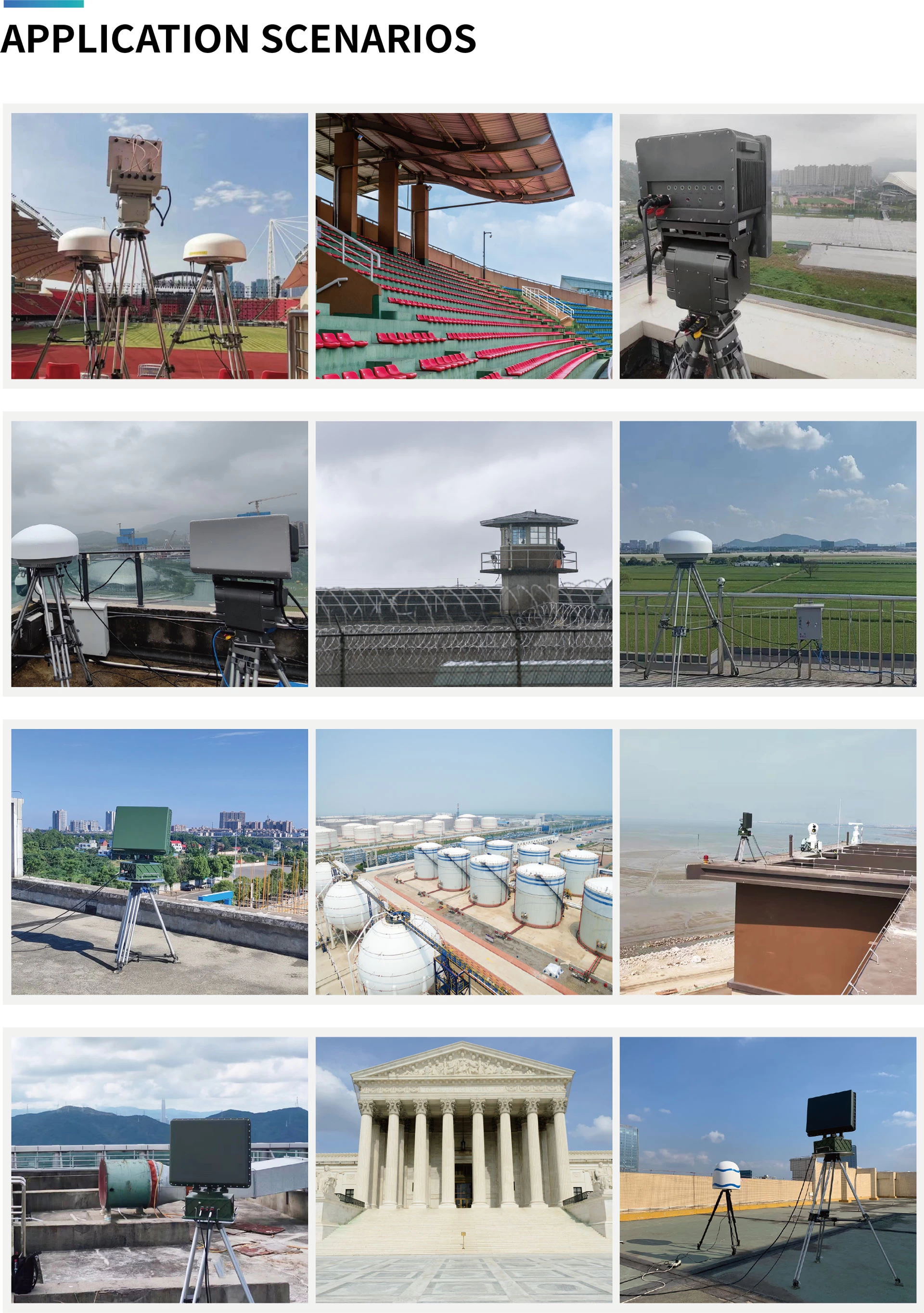
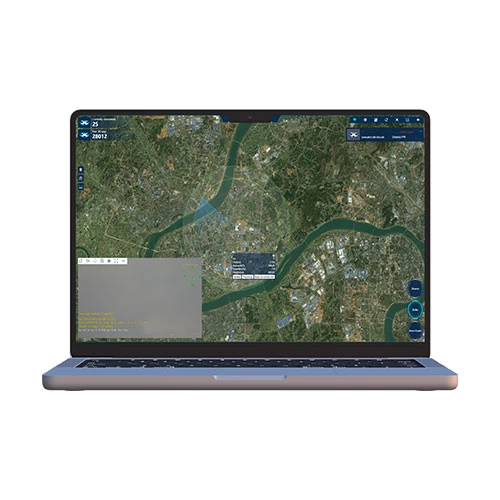
With average power consumption not exceeding 100 W and support for 7×24 unattended operation, it features built-in GPS auto north-alignment and multi-unit networking for 360° full-airspace coverage and cross-location, with linked execution of countermeasure strategies. A Web interface and RESTful API make it easy to integrate into existing security platforms. It is widely suited to low-altitude detection and operator tracing at airports, prisons, oil depots, borders, and other critical sites.
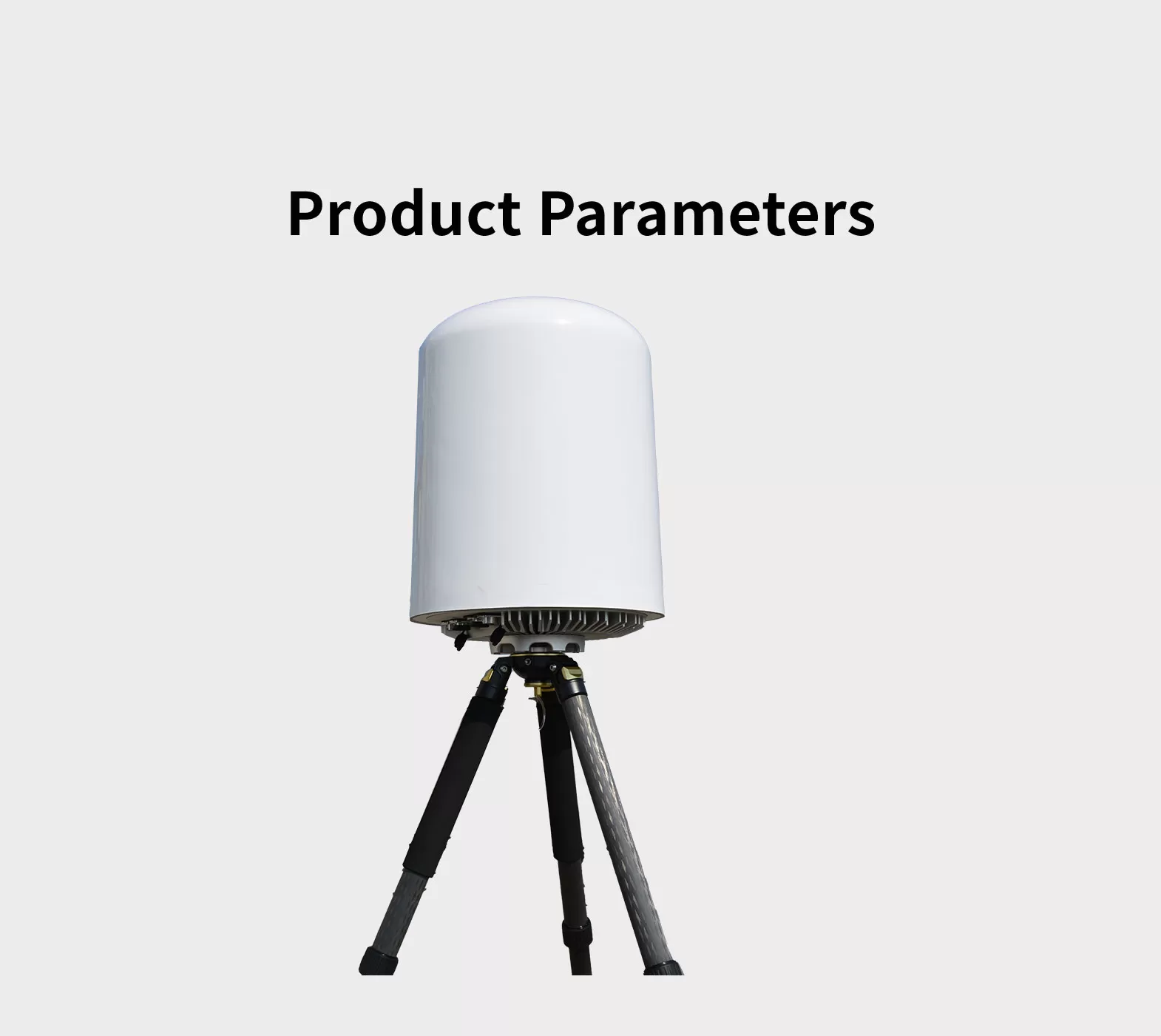
*ໃຫ້ສັງເກດວ່າການສະແດງ, ຂໍ້ມູນຈໍາເພາະແລະຫນ້າທີ່ອາດຈະແຕກຕ່າງໂດຍບໍ່ຕ້ອງແຈ້ງ.
| ຕົວແບບ | TXPP5000-S1 |
| Frequency range | 70 MHz ~ 10 GHz |
| ໄລຍະການກວດຫາສູງສຸດ | ≥3 ໄມລ໌ (5 ກ້ອຢ) Maximum detection distance can exceed 6 miles (10 ກ້ອຢ); actual performance may vary depending on the electromagnetic environment and drone type.) |
| Direction finding accuracy | ≤20°(ບັນຈຸ, Drone hovering condition; applicable to 2.4 GHz an 5 GHz bands only.) |
| ສູງສຸດພ້ອມກັນ ການຕິດຕາມ | ≥40 |
| Maximum detectable target speed | ≥±66 ft/s (±20 m/s) |
| ການຄຸ້ມຄອງ Azimuth | 0 ~ 360 ° |
| ການຄຸ້ມຄອງລະດັບຄວາມສູງ | 0 ~ 90°
|
| ການສະຫນອງພະລັງງານ | AC 80 ~ 264V / DC 113 ~ 370V |
| ການບໍລິໂພກພະລັງງານ | ≤ 100W |
| ອຸນຫະພູມເຮັດວຽກ | -20 ~ +60°C |
| ຂະໜາດ | ≤ 14 × 20 ໃນ (350*480 ມມ) (Diameter*Height) |
| ນ້ໍາຫນັກ | ≤ 33 lbs (15 ກິໂລ) (Main unit only, excluding mounting bracket) |
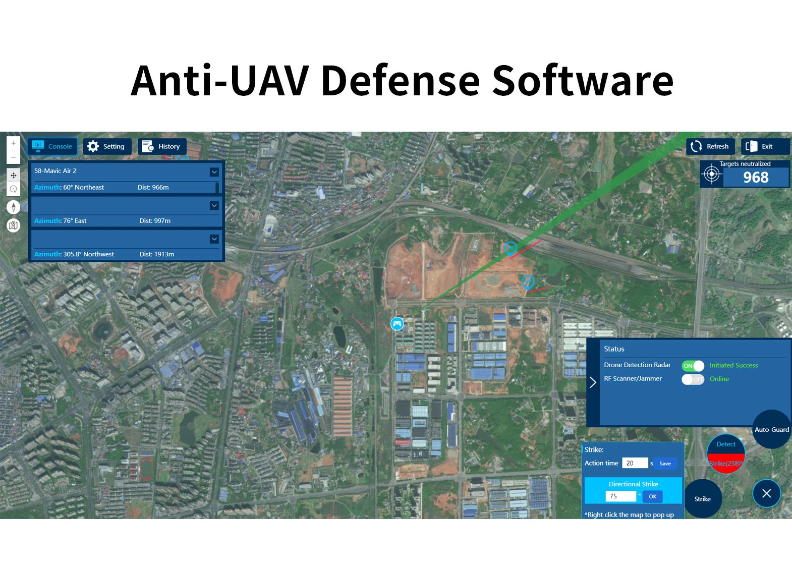
ລະບົບປ້ອງກັນປະເທດຕ້ານ UAV ແມ່ນປະກອບດ້ວຍອຸປະກອນທີ່ຢູ່ທາງຫນ້າເຊັ່ນ: ການຊອກຄົ້ນຫາ, ເຄື່ອງກວດ RF, ກ້ອງຕິດຕາມ E / O ຕິດຕາມ, RF Jammming ຫຼື Spoofing ອຸປະກອນແລະຊອບແວແພລະຕະຟອມ UAV. ໃນເວລາທີ່ droneentersters ເຂດປ້ອງກັນປະເທດ, ຫນ່ວຍງານຊອກຄົ້ນຫາຜົນໄດ້ຮັບຂໍ້ມູນທີ່ຖືກຕ້ອງໂດຍຜ່ານໄລຍະທາງທີ່ຫ້າວຫັນ, ແຈ, ຄວາມໄວແລະຄວາມສູງ. ກ່ຽວກັບການເຂົ້າໄປໃນເຂດເຕືອນໄພ, ລະບົບດັ່ງກ່າວຈະກໍານົດເອກະລາດແລະເລີ່ມຕົ້ນອຸປະກອນທີ່ວຸ້ນວາຍເພື່ອແຊກແຊງການສື່ສານ drone, ເພື່ອເຮັດໃຫ້ drone ກັບຄືນຫຼືການລົງຈອດ. ລະບົບສະຫນັບສະຫນູນອຸປະກອນທີ່ຫຼາກຫຼາຍແລະການຄຸ້ມຄອງເຂດຫຼາຍເຂດແລະສາມາດຮັບຮູ້ໄດ້ 7*24 - ສະພາບອາກາດຕິດຕາມກວດກາແລະປ້ອງກັນການສະແດງຂອງ Drone.
ລະບົບປ້ອງກັນປະເທດຕ້ານ UAV ປະກອບດ້ວຍຫນ່ວຍງານຊອກຫາ radar ຫຼື rf, ຫນ່ວຍບໍລິການຕິດຕາມ EO ແລະຫນ່ວຍ Jamming. ລະບົບປະສົມປະສານການຊອກຄົ້ນຫາເປົ້າຫມາຍ, ການຕິດຕາມ & ການຮັບຮູ້ໄຕ, ບັນຊາ & ຄວບຄຸມຄວາມວຸ້ນວາຍ, ຫຼາຍຫນ້າທີ່ໃນຫນຶ່ງ. ອີງຕາມສະຖານະການການສະຫມັກທີ່ແຕກຕ່າງກັນ, ລະບົບດັ່ງກ່າວສາມາດນໍາໃຊ້ໄດ້ຢ່າງຄ່ອງແຄ້ວເຂົ້າໄປໃນການແກ້ໄຂທີ່ດີທີ່ສຸດໂດຍການເລືອກຫນ່ວຍງານຊອກຄົ້ນຫາທີ່ແຕກຕ່າງກັນແລະອຸປະກອນ jamming. ການກວດສອບສາມາດຕິດຕັ້ງໄດ້, mobile ພາຫະນະທີ່ຕິດຢູ່ຫຼືພົກພາ. ໂດຍປະເພດການຕິດຕັ້ງຄົງທີ່, AURS ແມ່ນຖືກນໍາໃຊ້ຢ່າງກວ້າງຂວາງໃນສະຖານທີ່ປ້ອງກັນຄວາມປອດໄພໃນລະດັບສູງ, ປະເພດການຕິດຕາມພາຫະນະແມ່ນຖືກນໍາໃຊ້ເປັນປົກກະຕິສໍາລັບການລາດຕະເວນເປັນປົກກະຕິຫຼືຫຼາຍກວ່ານັ້ນ, ແລະປະເພດທີ່ມີກະເປົາຖືແມ່ນໃຊ້ຫຼາຍສໍາລັບການປ້ອງກັນຊົ່ວຄາວ & ການຄວບຄຸມໃນກອງປະຊຸມທີ່ສໍາຄັນ, ເຫດການກິລາ, CONCERT CONCTER.


WeChat
ສະແກນລະຫັດ QR ດ້ວຍ wechat